Drones and How They Changed the Surveying Industry
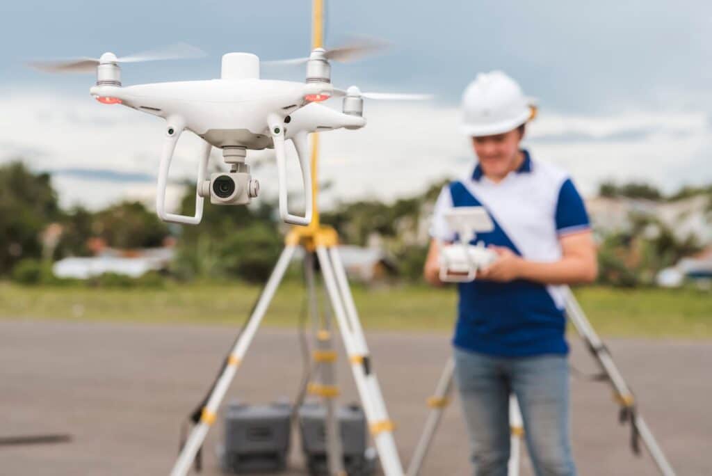
The surveying industry has seen remarkable advancements over the years, but one of the most significant game-changers has been the introduction of drone technology. Unmanned Aerial Vehicles (UAVs), commonly known as drones, have revolutionized how surveys are conducted, offering unparalleled efficiency, accuracy, and safety. Here’s an in-depth look at how drones have transformed the surveying industry and the benefits they bring.
Enhanced Efficiency and Speed
Traditionally, land surveys involved extensive ground work, requiring surveyors to physically traverse the terrain, often facing challenging and time-consuming conditions. Drones have drastically reduced the time needed for surveys. Equipped with high-resolution cameras and advanced GPS systems, drones can cover large areas quickly and capture detailed aerial images. This allows surveyors to complete projects in a fraction of the time compared to conventional methods.
Improved Accuracy and Precision
Accuracy is paramount in surveying, and drones excel in this aspect. Modern drones are equipped with sophisticated sensors and LiDAR (Light Detection and Ranging) technology, enabling them to capture precise measurements and create accurate 3D models of the surveyed area. These high-precision tools minimize human error and provide surveyors with reliable data, essential for planning and development projects.
Enhanced Safety
Surveying can often involve working in hazardous environments, such as steep terrains, dense forests, or construction sites. Drones mitigate these risks by allowing surveyors to conduct surveys remotely. This not only enhances the safety of the surveyors but also ensures that surveys can be conducted in areas that would be otherwise inaccessible or dangerous.
Cost-Effectiveness
While the initial investment in drone technology might seem significant, the long-term benefits and cost savings are substantial. Drones reduce the need for extensive manpower and equipment, lowering overall survey costs. Additionally, the speed and efficiency of drone surveys mean that projects can be completed faster, reducing labor costs and increasing productivity.
Versatility and Flexibility
Drones offer unparalleled versatility in surveying applications. They can be used for a wide range of surveys, including topographic surveys, construction site monitoring, agricultural assessments, and environmental studies. Their ability to capture high-resolution images and videos from various angles provides comprehensive data, making them a valuable tool for surveyors across different industries.
Data Integration and Analysis
The data collected by drones can be easily integrated with other technologies and software used in the surveying industry. For instance, Geographic Information Systems (GIS) and Building Information Modeling (BIM) can utilize drone data to create detailed maps, models, and simulations. This integration enhances data analysis, providing more insights and improving decision-making processes for surveyors and their clients.
The introduction of drones has undeniably transformed the surveying industry, offering enhanced efficiency, accuracy, safety, and cost-effectiveness. As technology continues to evolve, the capabilities of drones in surveying will only expand, providing even more benefits and opportunities for surveyors. Embracing drone technology is no longer an option but a necessity for surveyors looking to stay competitive and deliver the best results for their clients.
For those in the surveying industry, understanding and leveraging drone technology is crucial. It’s not just about keeping up with the times but about harnessing the power of innovation to drive better outcomes and redefine the standards of surveying excellence.
Contact SiteOps Land Surveying & Mapping in Prescott, Arizona for topographic surveying.